December 31st: New Years Eve in the Antarctic
Dad, Josh, and I got up super early because we were told we would be arriving at Deception Island at 6:00 AM!
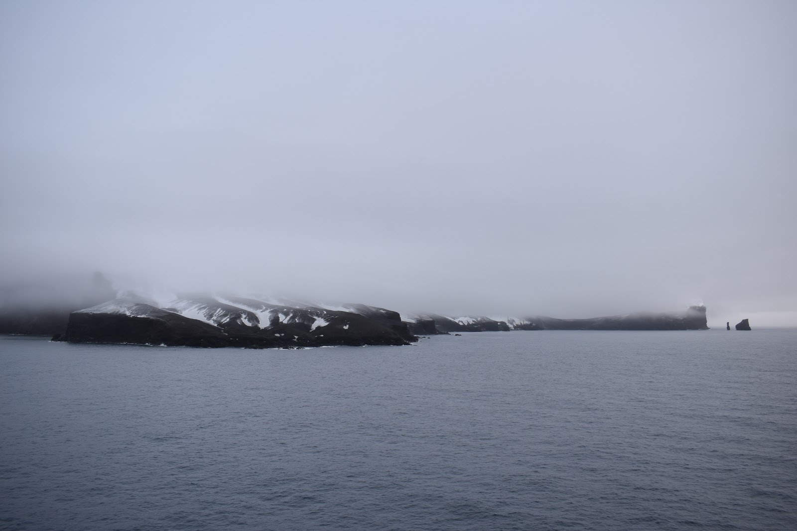
Deception Island is located in the South Shetland Islands archipelago. It was named Deception Island because the sailers who discovered it thought it was an island until they saw the Neptune's Bellows and the large, safe bay within. The bay is actually an active caldera volcano! A violent eruption about 10,000 years ago caused the volcano's summit to collapse and formed the flooded caldera in the center of the island. Throughout history it was used by whalers and seal hunters. Now it is used as a research station and tourist destination.
[Purple line]

[It snowed!]

And the Captain didn't lie! Right at 6:00 AM we were able to see the infamous Deception Island!

[My GPS]

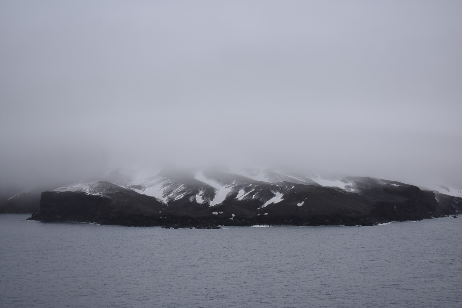
We arrived at the very southwestern point, which is where Lavebrua Island is.
Dad, Josh, and I got up super early because we were told we would be arriving at Deception Island at 6:00 AM!
Deception Island is located in the South Shetland Islands archipelago. It was named Deception Island because the sailers who discovered it thought it was an island until they saw the Neptune's Bellows and the large, safe bay within. The bay is actually an active caldera volcano! A violent eruption about 10,000 years ago caused the volcano's summit to collapse and formed the flooded caldera in the center of the island. Throughout history it was used by whalers and seal hunters. Now it is used as a research station and tourist destination.
[Purple line]

[It snowed!]

And the Captain didn't lie! Right at 6:00 AM we were able to see the infamous Deception Island!

[My GPS]

We arrived at the very southwestern point, which is where Lavebrua Island is.
[Lavebrua Island]

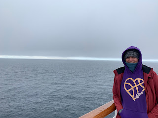
[It was raining/snowing so I stayed in the Crows Nest while Josh was out on deck.]

Even before we got to the island you can see hundreds of chinstrap penguins in the water.


We headed north-northeast from Lavebrua Island towards Deception Island where we cruised pass Neptune's Bellows (the opening to the culdera). The ship is too large to fit through the bellows, so we continued on our way to the east side of the island.
[Deception Island with Neptune's Bellows on the right side]


[Lavebrua Island]

[Neptune's Bellows]


We rounded the southeastern side of the island where we saw the Sewing-machine Needles Islands.


[Sewing-machine Needles Islands]

[More Chinstrap Penguins]


[Sewing-machine Needles Islands and a sailboat]


[Small Chinstrap Penguin colony]


We passed by the Sewing-machine Needles Islands and arrived at Baily Head (the eastern most point of the island), where we saw this HUGE (~130,000) penguin colony!


We were able to get a few pictures of the colony before the fog came down from Mount Pond and covered the shore.
The EXC Expedition Team Leader, Scott, then came on the loud speaker and told us that we were going to be heading straight east, through the Bransfield Strait, to try and find an 11-mile long iceberg called A57A! He said they had been tracking it for a while and they had a pretty good idea of where it was!
We grabbed some seats in the Crows Nest and waited while the Zaandam went iceberg hunting.
The EXC Expedition Team had some maps laid out in the Crows Nest. One of them had some information about Antarctica.


[Bransfield Strait]

We cruised east through the Bransfield Strait, just south of the South Shetland Islands.
[South Shetland Islands]


At about 9:30 AM we started to see a LARGE, white block sitting along the horizon. We had found A57A!


Once we got closer to the iceberg, the Captain turned the Zaandam north and headed up along it!


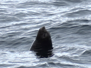
While I was inside the Crows Nest looking at the glacier I looked at the water and saw a black head bobbing in the water. I thought it was a black balloon or buoy. Josh was out on deck and saw it too, so he took a picture. We later zoomed in on it and saw that it was a LEOPARD SEAL! This was the first and only one we had seen on the trip! I would have been very sad if I came all the way to Antarctica and didn't see a leopard seal!


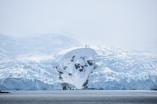
As we continued our journey along the iceberg we were told by Bryan, the Geologist, that icebergs are named after the location where they broke off. A57A broke off of the Antarctic mainland and is currently 11 miles long, 5 miles wide, and 120 feet high! Just imagine what is under water!


[Bryan said that this is likely were the iceberg will break]

[The sun shinning through it made it glow blue! It was so pretty!]


[Calving]


[Iceberg that had flipped over]


[Humpback whale]


[Albatross]


[Humpback waving]

We left A57A behind and continued north to one of the South Shetland Islands: King George Island. This island is the largest of the South Shetland Islands and is inhabited by scientist staying in numerous research stations. This island is also where the "Antarctica Marathon" takes place. We headed into Admiralty Bay. This large, gorgeous bay has three fjords, at least 15 tidewater glaciers, research stations, large penguin colonies, and tons of extinct volcano cores.


[Extinct volcano cores]


[Research station]


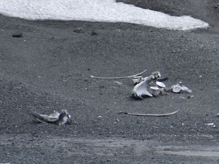
[Whalers use to use this bay to chop up their captured whales. The bones of the whales remain to this day.]


[Extinct volcano core]


[Whale bones]

[Look for the green (not pink), this is where the penguin colonies are!]


[Huge penguin colony]


[Penguins EVERYWHERE!]


As we exited Admiralty Bay I was sad. I LOVED Antarctica! I knew Antarctica would be amazing, but I had no idea it would look like this! I thought we would be looking at a giant ice sheet with some impressive ice cliffs, but it’s so majestic and peaceful with high rocky peaks poking out beneath sheets of ice and snow. The mountains are continuous, the sky is blue, the water is clear and calm, and I couldn’t get enough of it! I’m going to miss waking up every day to icebergs floating pass my window.
That night was New Years Eve so we had a gala night. We dressed up, went to dinner, and then went to see comedian Mark Palmer perform on the MainStage.


[Last sunset in Antarctica!]


[It was raining/snowing so I stayed in the Crows Nest while Josh was out on deck.]

Even before we got to the island you can see hundreds of chinstrap penguins in the water.


We headed north-northeast from Lavebrua Island towards Deception Island where we cruised pass Neptune's Bellows (the opening to the culdera). The ship is too large to fit through the bellows, so we continued on our way to the east side of the island.
[Deception Island with Neptune's Bellows on the right side]


[Lavebrua Island]

[Neptune's Bellows]


We rounded the southeastern side of the island where we saw the Sewing-machine Needles Islands.


[Sewing-machine Needles Islands]

[More Chinstrap Penguins]


[Sewing-machine Needles Islands and a sailboat]


[Small Chinstrap Penguin colony]


We passed by the Sewing-machine Needles Islands and arrived at Baily Head (the eastern most point of the island), where we saw this HUGE (~130,000) penguin colony!


We were able to get a few pictures of the colony before the fog came down from Mount Pond and covered the shore.
The EXC Expedition Team Leader, Scott, then came on the loud speaker and told us that we were going to be heading straight east, through the Bransfield Strait, to try and find an 11-mile long iceberg called A57A! He said they had been tracking it for a while and they had a pretty good idea of where it was!
We grabbed some seats in the Crows Nest and waited while the Zaandam went iceberg hunting.
The EXC Expedition Team had some maps laid out in the Crows Nest. One of them had some information about Antarctica.


[Bransfield Strait]

We cruised east through the Bransfield Strait, just south of the South Shetland Islands.
[South Shetland Islands]


At about 9:30 AM we started to see a LARGE, white block sitting along the horizon. We had found A57A!


Once we got closer to the iceberg, the Captain turned the Zaandam north and headed up along it!


While I was inside the Crows Nest looking at the glacier I looked at the water and saw a black head bobbing in the water. I thought it was a black balloon or buoy. Josh was out on deck and saw it too, so he took a picture. We later zoomed in on it and saw that it was a LEOPARD SEAL! This was the first and only one we had seen on the trip! I would have been very sad if I came all the way to Antarctica and didn't see a leopard seal!


As we continued our journey along the iceberg we were told by Bryan, the Geologist, that icebergs are named after the location where they broke off. A57A broke off of the Antarctic mainland and is currently 11 miles long, 5 miles wide, and 120 feet high! Just imagine what is under water!


[Bryan said that this is likely were the iceberg will break]

[The sun shinning through it made it glow blue! It was so pretty!]


[Calving]


[Iceberg that had flipped over]


[Humpback whale]


[Albatross]


[Humpback waving]

We left A57A behind and continued north to one of the South Shetland Islands: King George Island. This island is the largest of the South Shetland Islands and is inhabited by scientist staying in numerous research stations. This island is also where the "Antarctica Marathon" takes place. We headed into Admiralty Bay. This large, gorgeous bay has three fjords, at least 15 tidewater glaciers, research stations, large penguin colonies, and tons of extinct volcano cores.


[Extinct volcano cores]


[Research station]


[Whalers use to use this bay to chop up their captured whales. The bones of the whales remain to this day.]


[Extinct volcano core]


[Whale bones]


[Look for the green (not pink), this is where the penguin colonies are!]


[Huge penguin colony]


[Penguins EVERYWHERE!]


As we exited Admiralty Bay I was sad. I LOVED Antarctica! I knew Antarctica would be amazing, but I had no idea it would look like this! I thought we would be looking at a giant ice sheet with some impressive ice cliffs, but it’s so majestic and peaceful with high rocky peaks poking out beneath sheets of ice and snow. The mountains are continuous, the sky is blue, the water is clear and calm, and I couldn’t get enough of it! I’m going to miss waking up every day to icebergs floating pass my window.
That night was New Years Eve so we had a gala night. We dressed up, went to dinner, and then went to see comedian Mark Palmer perform on the MainStage.


[Last sunset in Antarctica!]


If you get the chance to go to Antarctica I HIGHLY recommend you go. You will not regret it! For those of you who have been to Alaska, I would have to say that Antarctica is like Alaska on steroids! 100% worth it!
No comments:
Post a Comment